GEONEON WILDFIRE SEVERITY INDEX DATASHEET
GET YOUR DATASHEET NOW
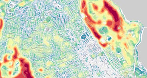
Uncover the power of Geoneon's Wildfire Severity Index. Our cutting-edge solution leverages advanced AI algorithms and the latest satellite imagery to predict wildfire severity. Whether you are involved in emergency management, urban planning, infrastructure protection, environmental conservation, or any sector requiring precise wildfire hazard data, Geoneon is here to enhance your approach to wildfire long-term preparedness.

Join the ranks of professionals safeguarding communities and critical assets with Geoneon's data. Fill out the form to download your datasheet and discover how the Geoneon Wildfire Severity Index can make a difference for you.